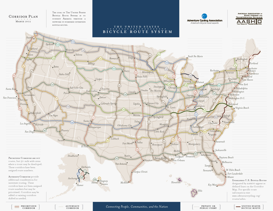
As it turns out my site is within a mile of the proposed nation wide route connecting America through a network of numbered interstate bicycle routes.
| As it turns out my site is within a mile of the proposed nation wide route connecting America through a network of numbered interstate bicycle routes.
0 Comments
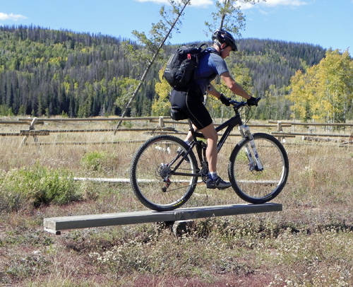
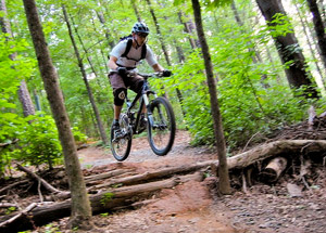
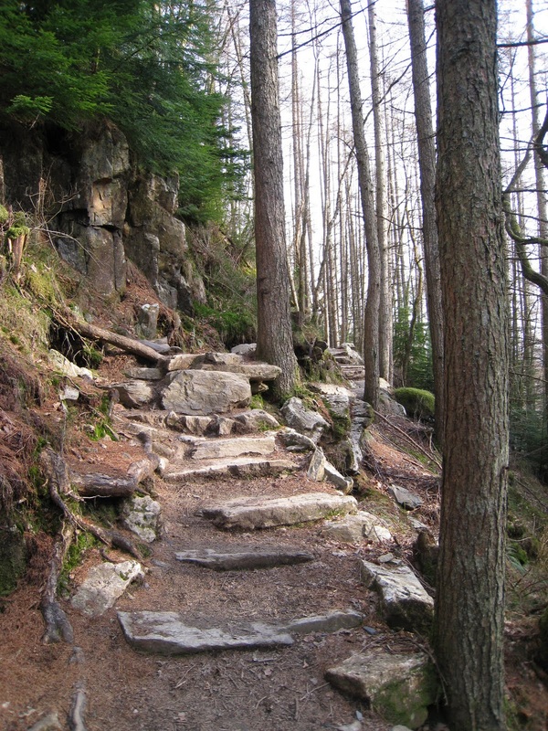
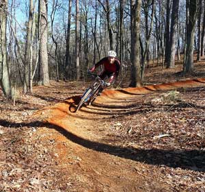
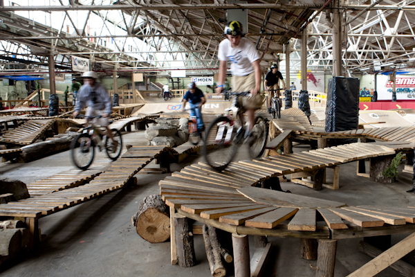
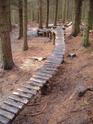
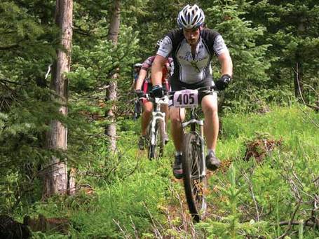
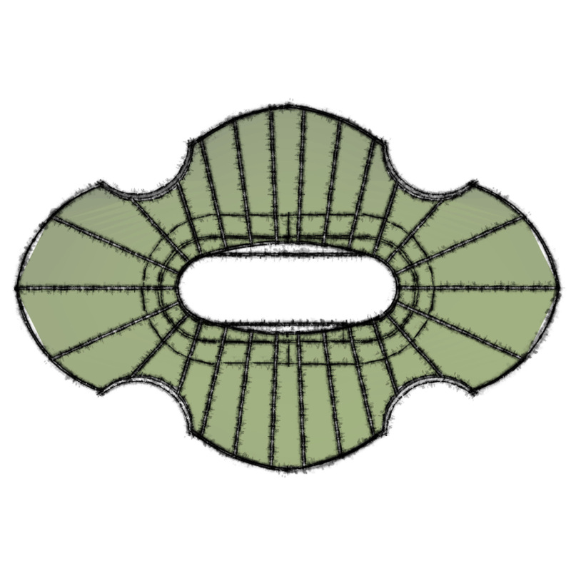
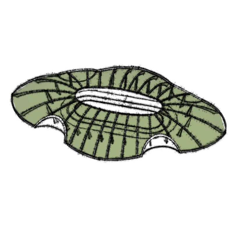
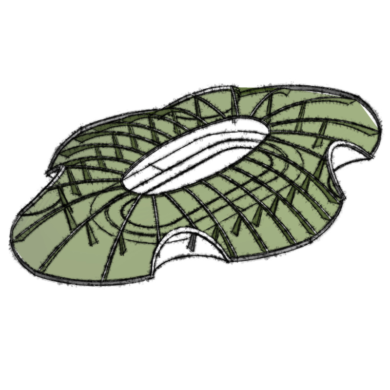
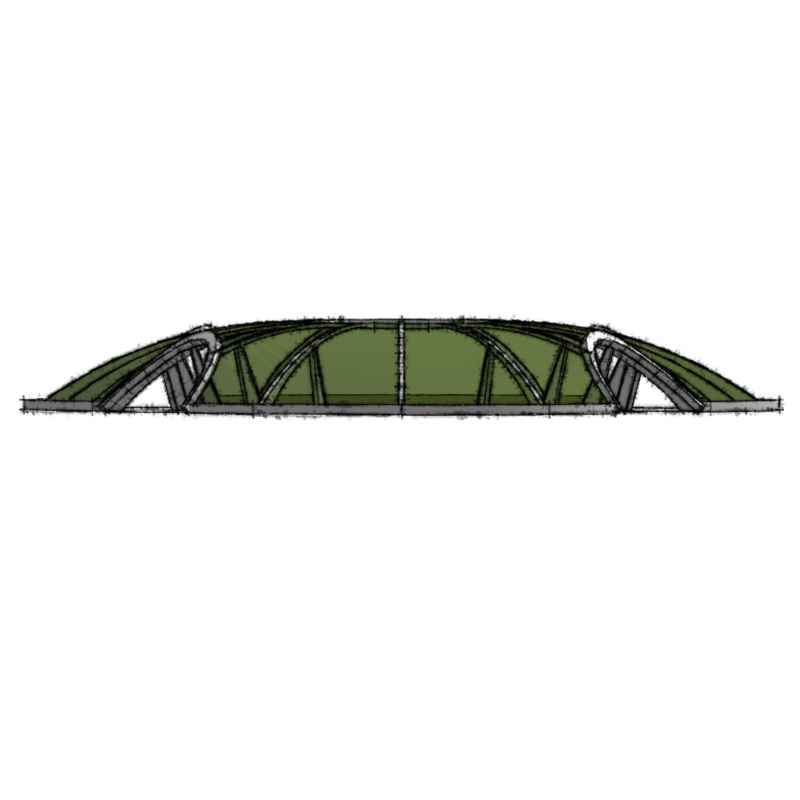
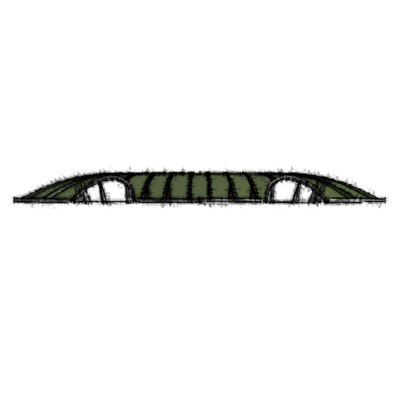
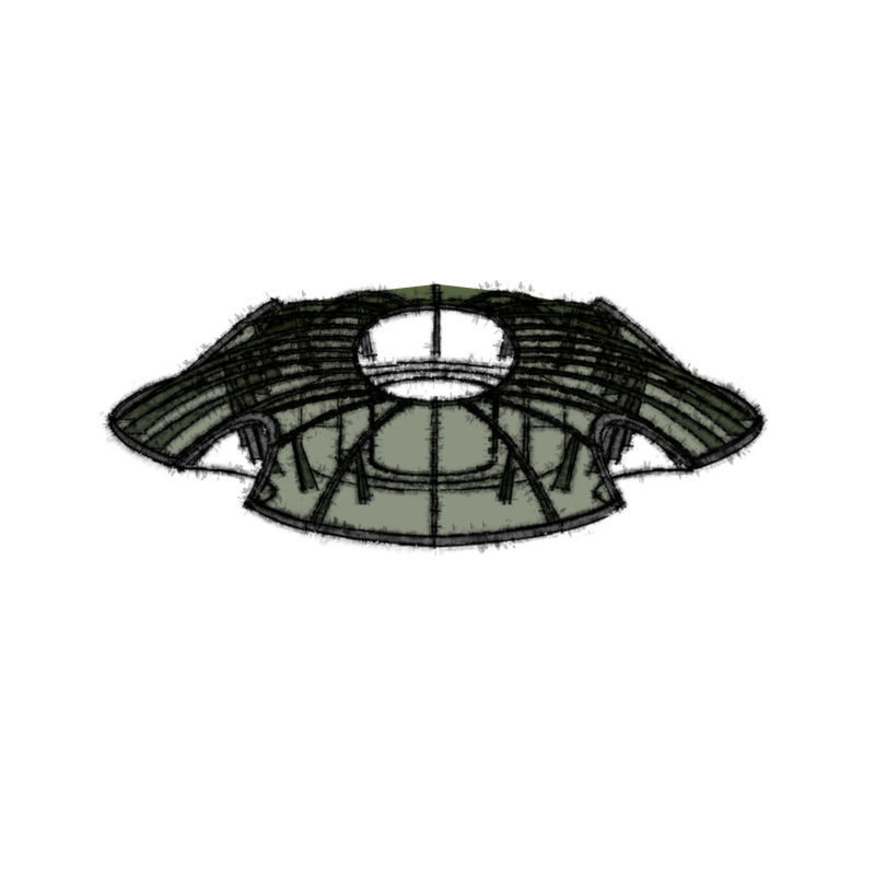
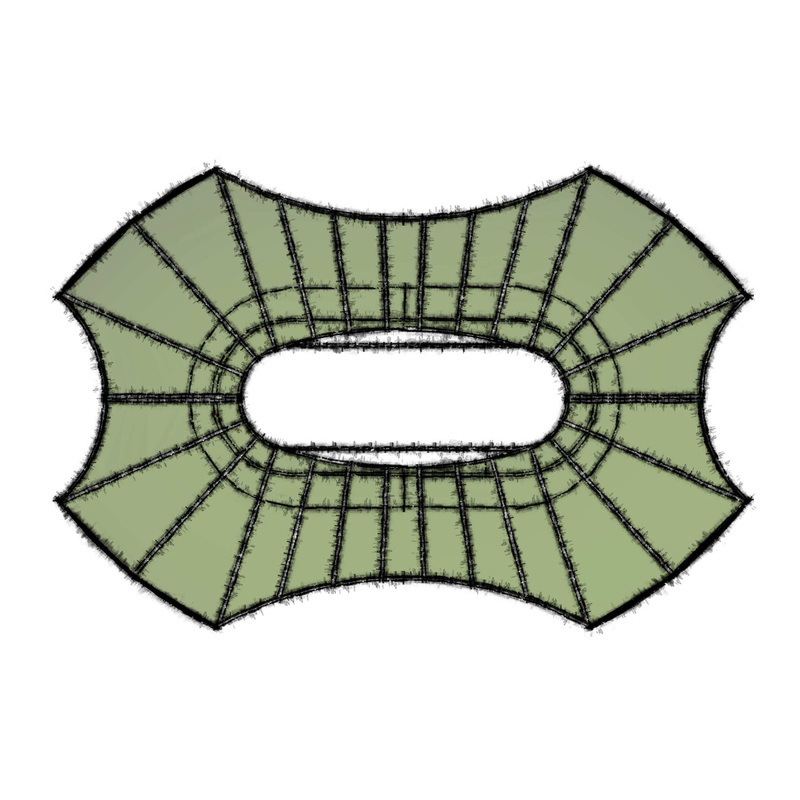
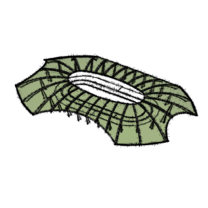
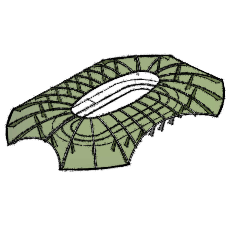
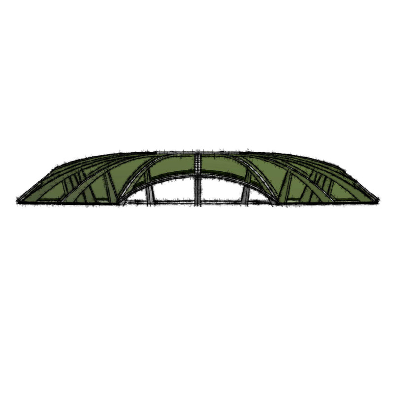
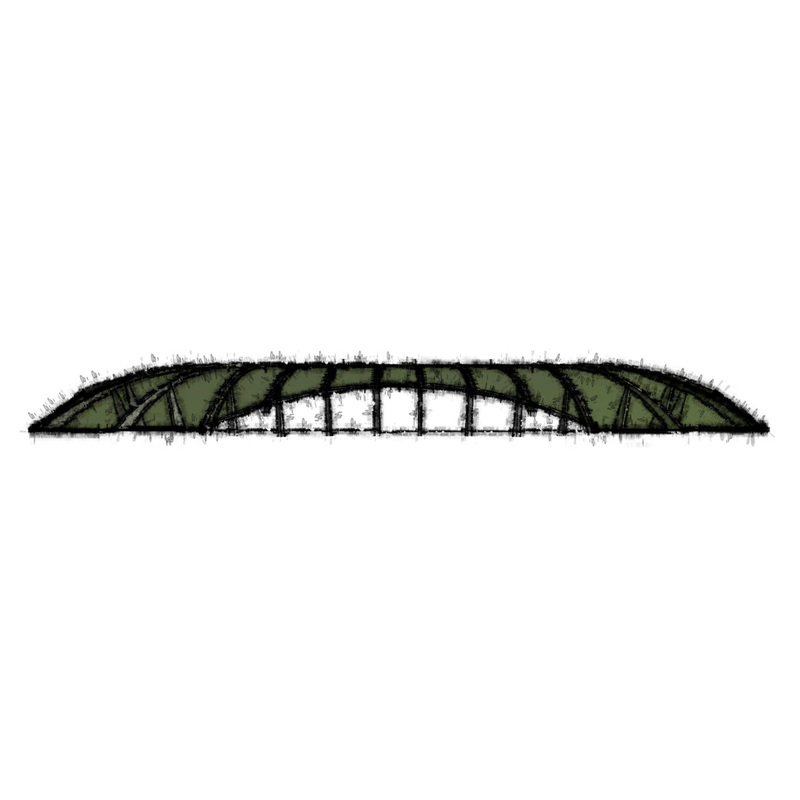
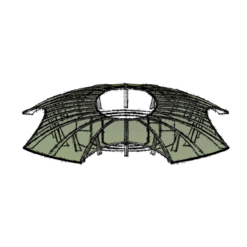
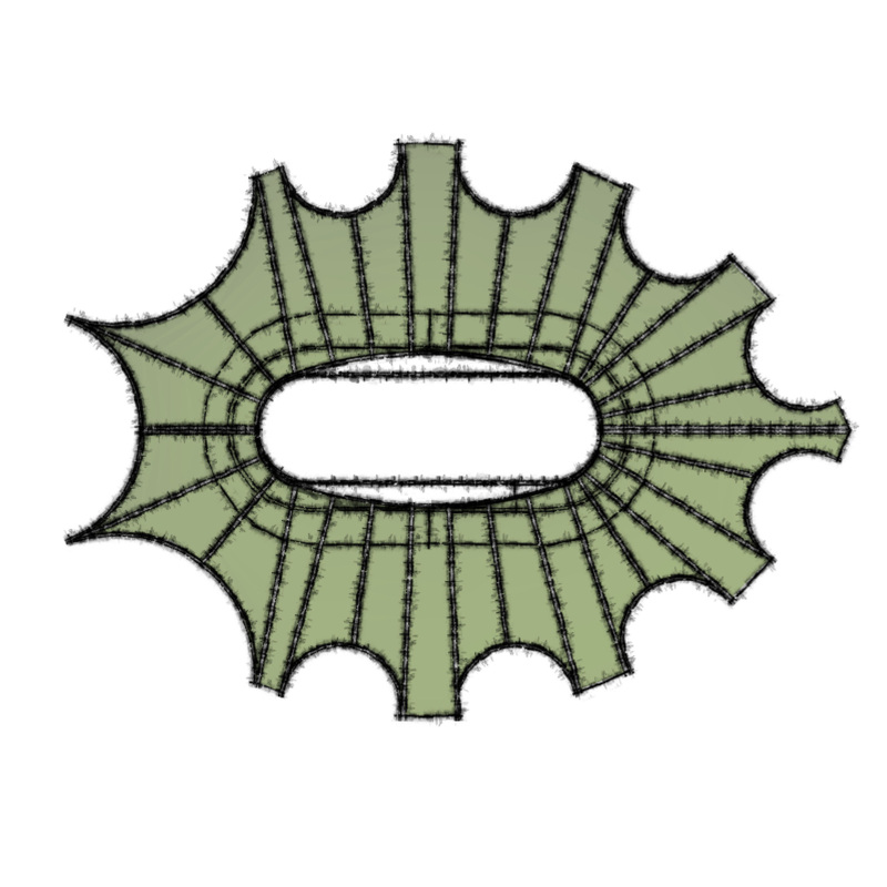
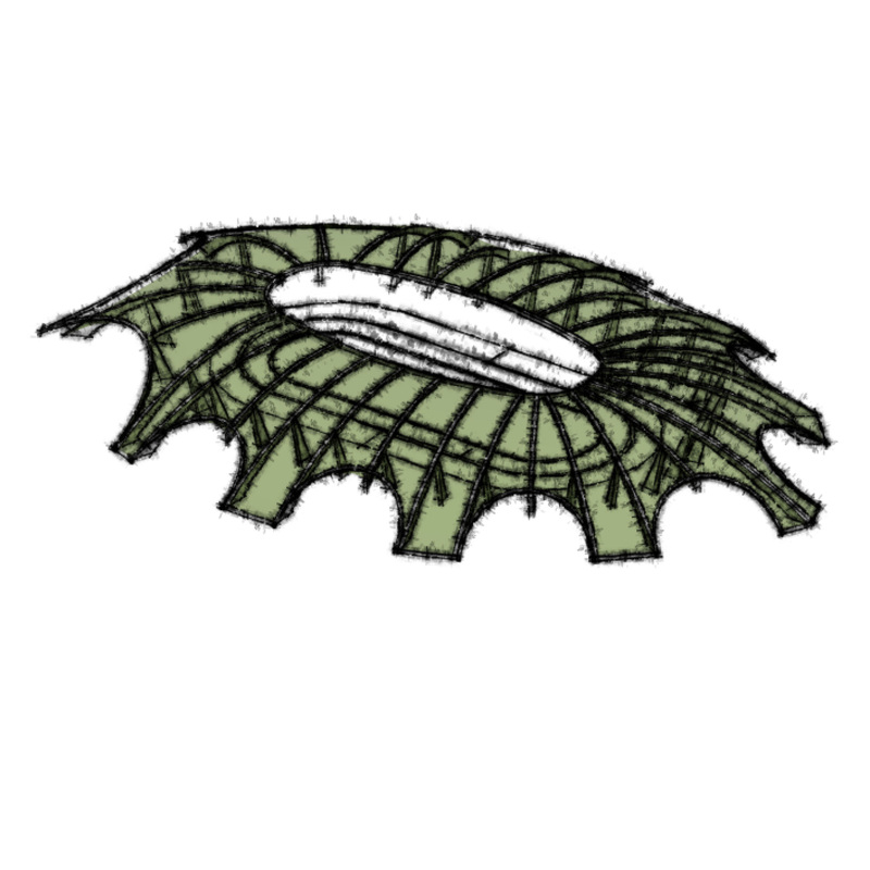
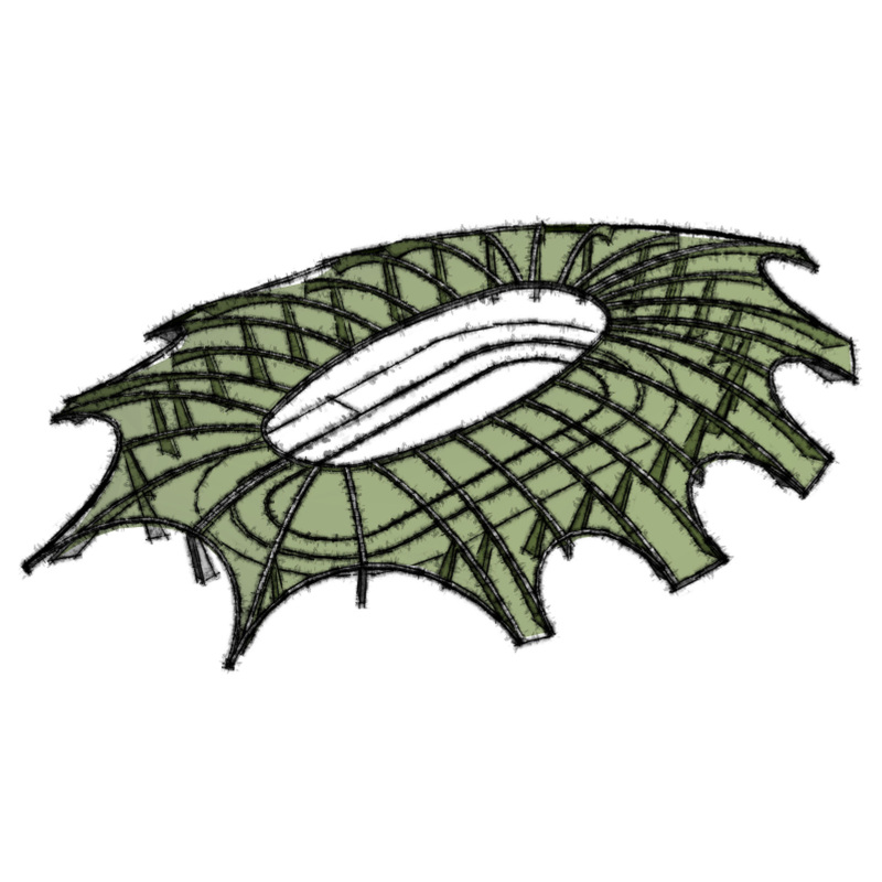
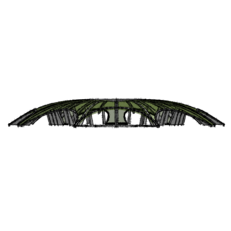
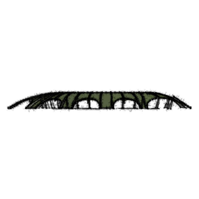
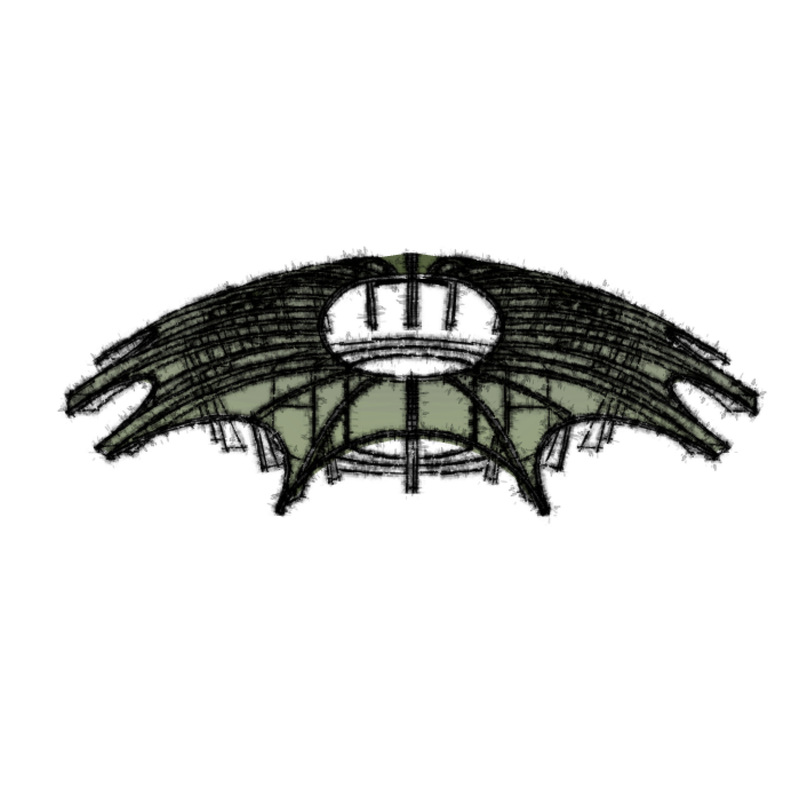
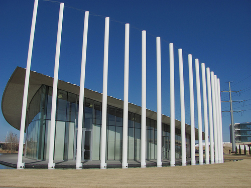
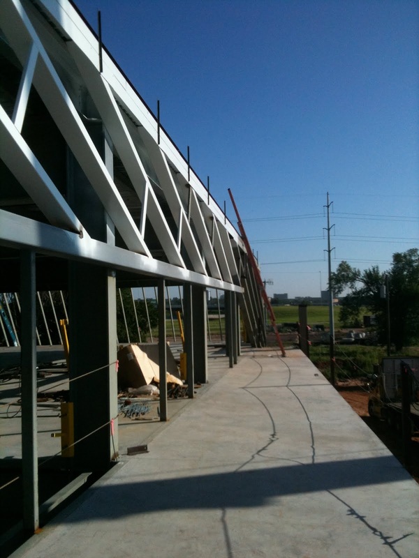
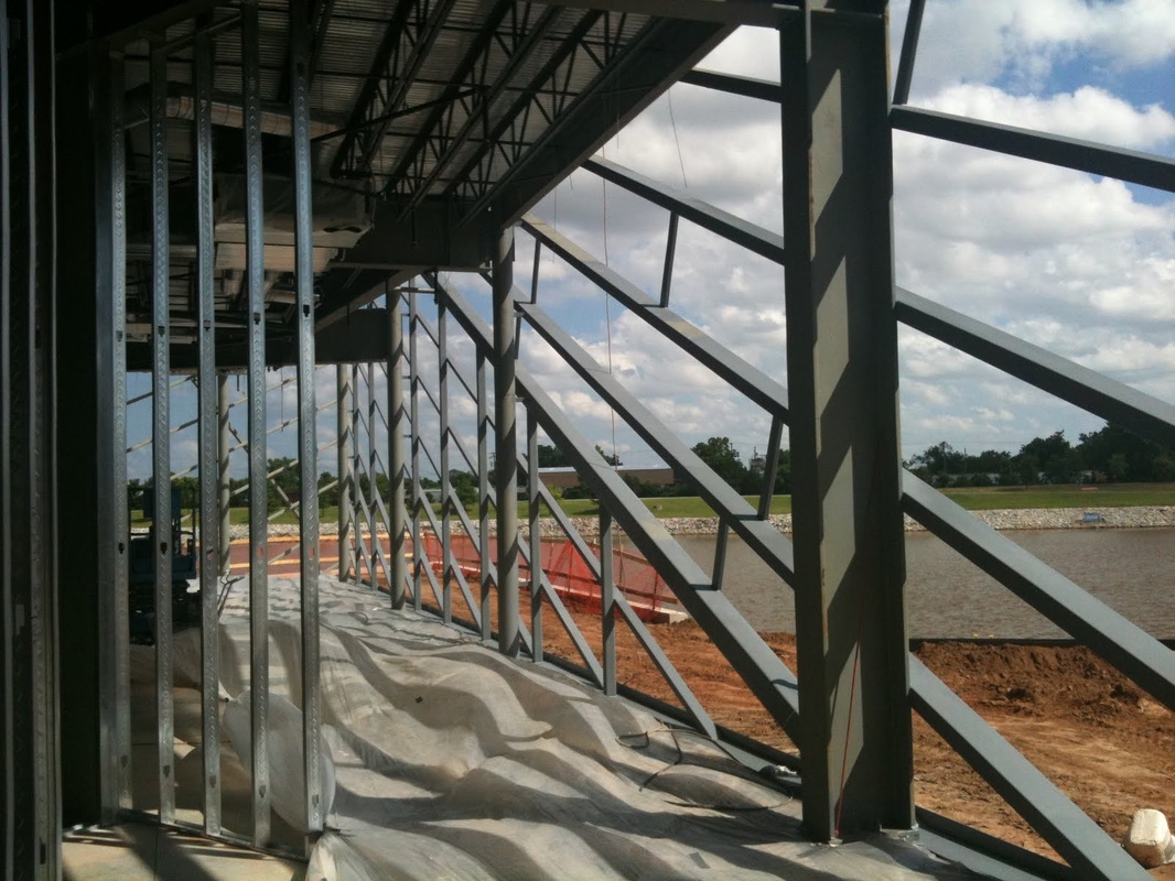
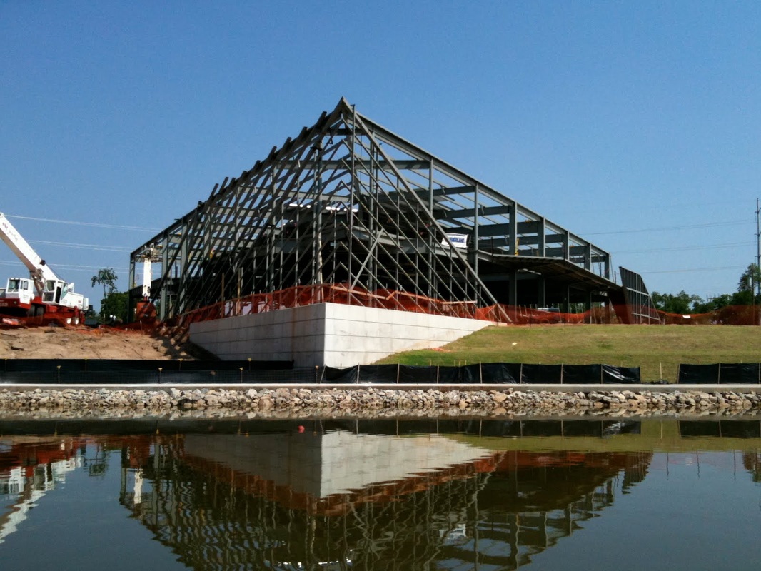
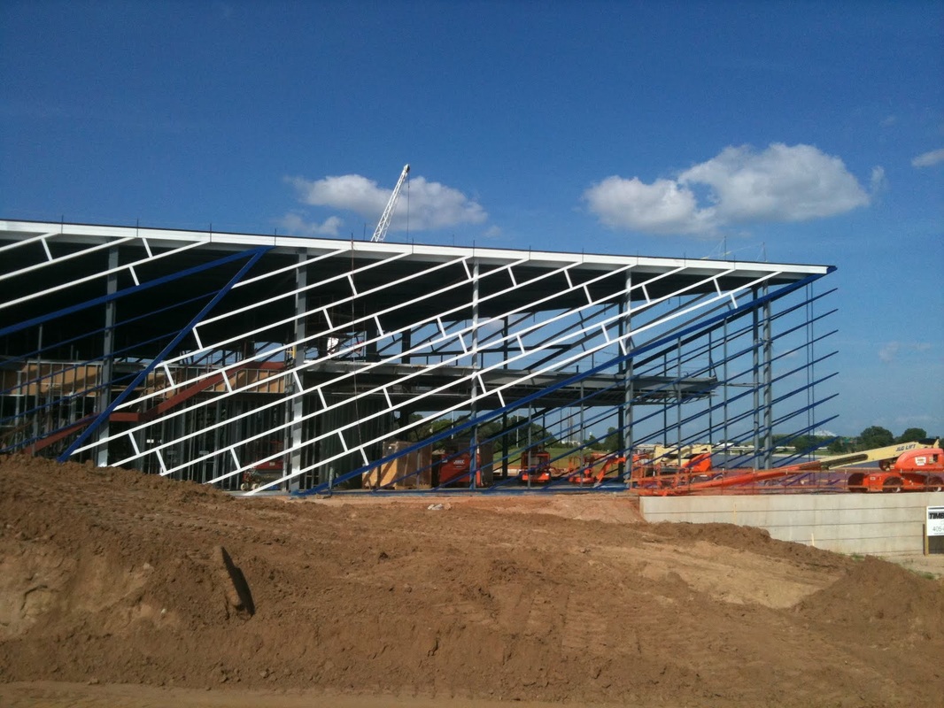
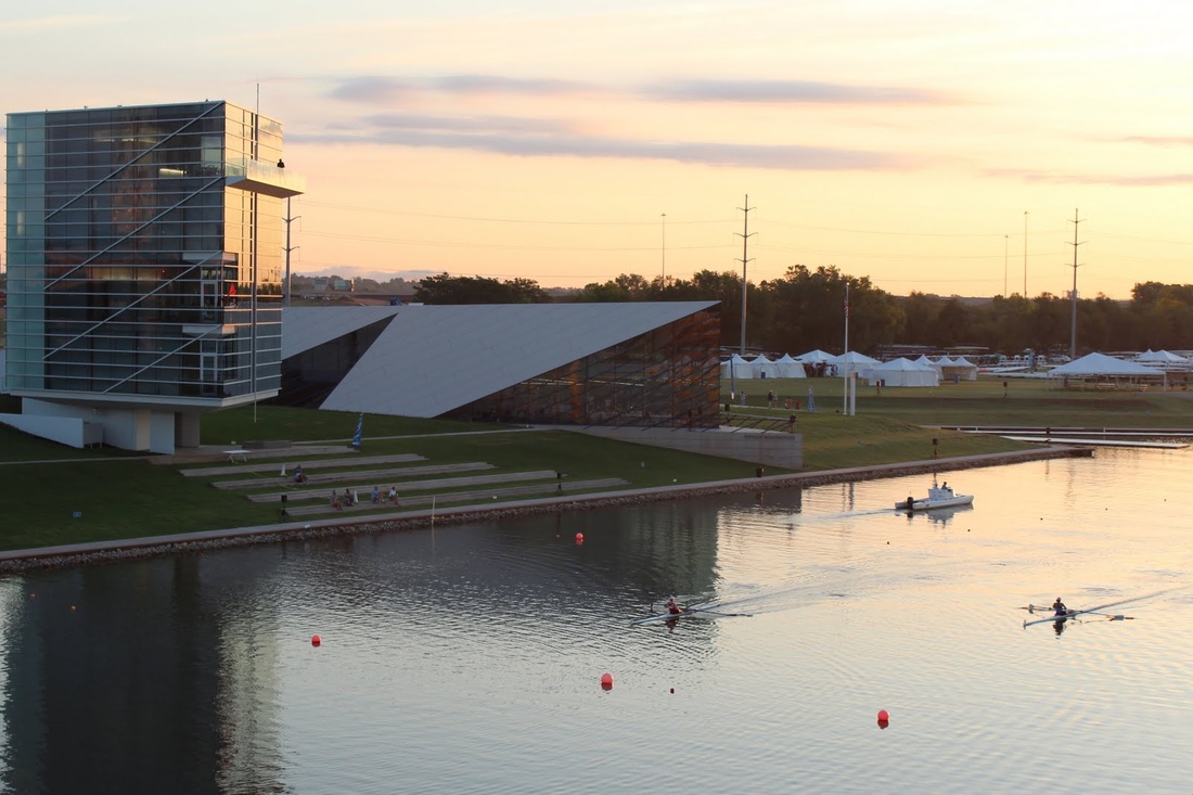
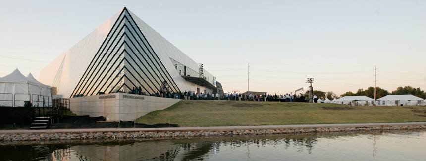
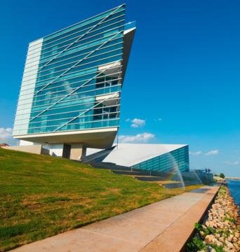
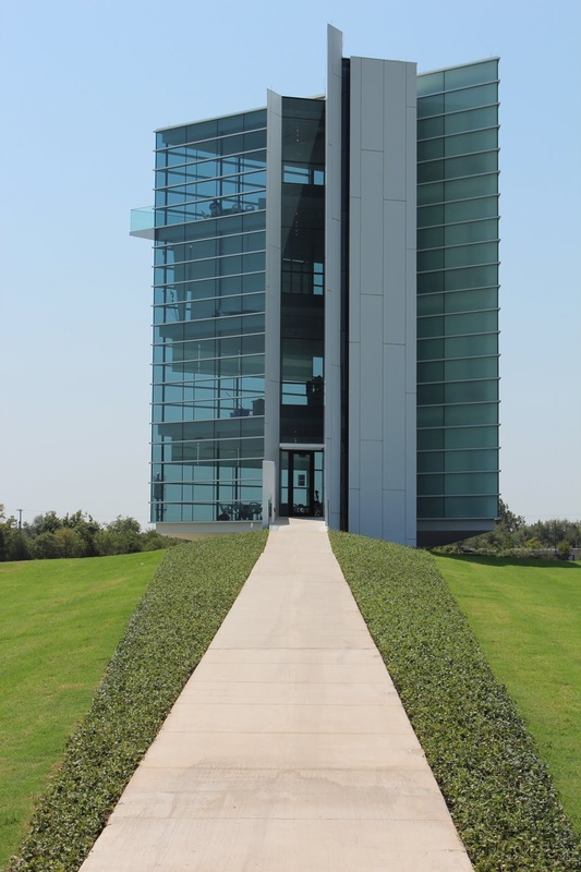
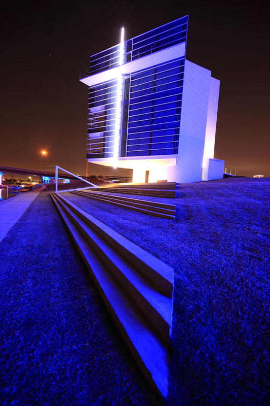
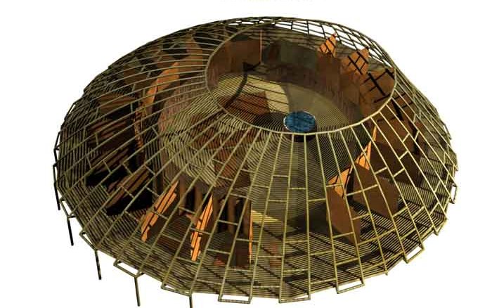
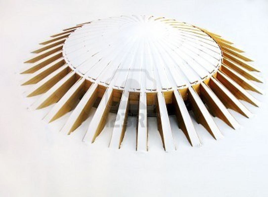
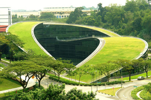
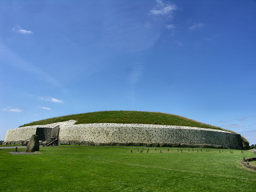
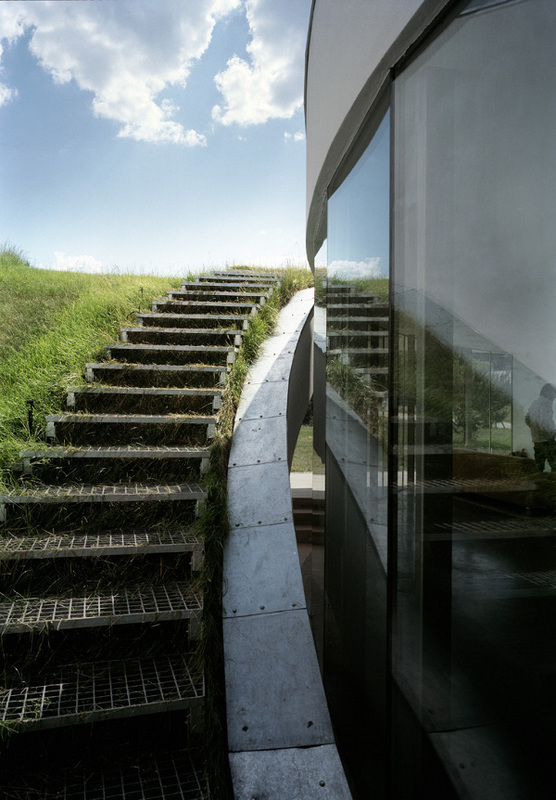
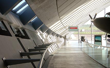
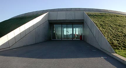
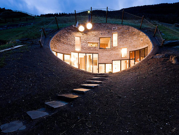
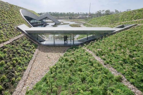
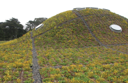
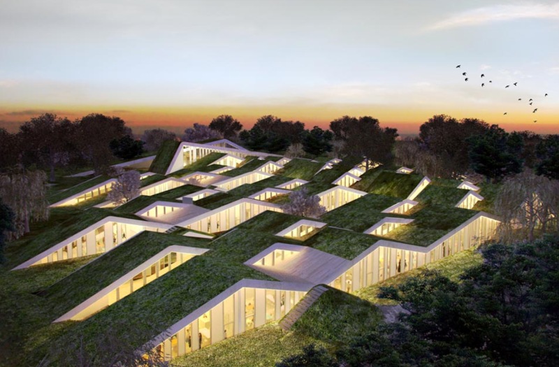
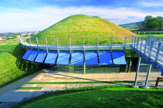
There is plenty of room for argument in trying to define what is and is not a mountain bike trail. In an attempt to keep things simple, I'll define a mountain bike trail as an off-road, natural surfaced trail where the use of a fat tire bicycle has a substantial advantage over the use of a skinny tire bicycle. This isn't to say that you couldn't ride a skinny tire bike on a mountain bike trail, only that it would be far more difficult. Some characteristics of mountain bike trails would include hardpacked dirt, loose dirt, mud, sandy, or gravelly surfaces, protruding rocks and roots, uneven surfaces, steep hills, ledges, downed trees, water crossings, and narrow sections of trail. Because there is such a diversity of mountain bike trails, it may be simpler to state what is not a mountain bike trail. Paved bike pathssuch as asphalt trails or crushed stone surfaced trails (like rails-to-trails conversions) are generally not considered to be mountain bike trails since they are usually easily ridden with a skinny tire road or touring bike. Also found a PDF online on Partland, OR Trail Design Guidlines that I plan to follow Here are some examples of obstacles one would create/encounter to make riding in flatter areas more challenging The structure I am looking at is the arch supporting the weight all the way to the ground. This is the easiest way to allow access to the roof by bike or foot. The center oval area would be a giant opaque skylight allowing the entire track to be day lit without creating hot spots or shadows on either the track or spectator seating area. The idea of this is to do a green roof over the structure so it would look like a giant grassy hill. Structure #1Very symmetrical building with 4 main small cutouts/entrances. I was thinking of using each one as a gate to that particular sport (track, cyclocross, mountain, crit) so that entrance could act as a meeting/waiting point for people entering/leaving the facility. Structure #2Same as above but with larger openings and more N/S/E/W opening configuration. This allows for more exterior glass which would help it to be recognized as a building and not a giant hill from I-35 and the boathouse district across the river. Structure #3This option has larger cutouts at the main entrance (left side) and smaller ones around the rest of the building. In this option I plan to stop the exterior wall at the column row this allowing the rest of the space to be covered exterior with the smaller circles acting as protected sitting/meeting areas so you can watch the action at the river as well as people riding around the site and on top of the building. This option is an evolution of the above structure system as well as my favorite of the 3. It still allows access to the roof (mainly on the back side) as well as creating stunning views under the green roof at the building itself. Moving the exterior wall inside the green roof allows me to use more glass and create better views around the area. With my site being within the Boathouse District I want to continue the theme of buildings in the area so here are images of the 2 existing boat houses. Since the form of these two building relate directly to the art of rowing my building form will not match, however I plan to use simmular materials, finishes and lighting. Chesapeake BoathouseDevon Boathouse & Finishline TowerPer my committee members comments I am going to start studying and building 3 structural models to help figure out what system would be best suited for my building. Below I listed the 3 main "natural disaster" features that I will have to base my designs on since these are relevant to the OKC area. 1. Wind Loads 2. Tornado 3. Earthquake I will also have to keep in mind span distances of such structural systems since I am wanting to keep the track as open as possible and free of columns interfering with sight lines. The images below are of the first structural system that fits my above criteria. The Arched or Domed roof will allow me to span greater distance with fewer materials as long as I buttress the exterior walls and allow the weight the be distributed into the earth. The dome also fulfills a second idea I had in mind as to allowing the building to apart of the outdoor cycling design. With Oklahoma being so flat (especially on my site) trying to integrate a mountain bike facility is quite challenging. Being able to have a green roof we are able to create our own hills and valleys on top of our buildings would be ideal and would keep up from having to import dirt and such from around the area. It will also help with energy needs in the summer since the earth is such a good insulator. I will start pulling parts from the images below and start modeling the structural system for my building. Per my meeting on Tuesday (5-15-12) I was approved for everything prior to this point and able to proceed...
Marjorie- I was asked to visit the site over the summer and start sketching some ideas Ronald- I was asked to further go into detail with my facilities linkage to the downtown OKC area and surrounding facilities Kwang- I was asked to start looking at structural systems for my building keeping in mind the natural elements associated with the OKC area (wind, Tornado and Earthquakes) and make 3 study models of those systems to be able to begin discussing them. All of which we will begin to discuss the begining of the Fall 2012 semester... 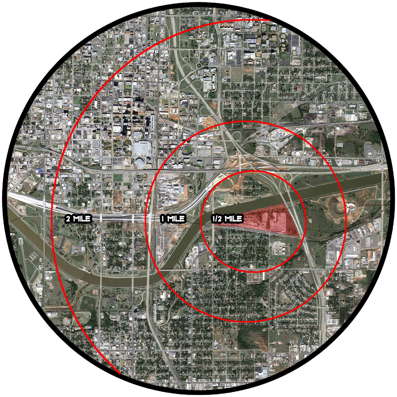 All models will be round Now that the research is all done and the location has been selected it is time to start getting in depth with the site and surrounding area. This first model will be at 1"=400' scale so you can see my sites location in relation to the downtown OKC area. On this model I plan to show key features of the area using colored push pins I plan to show the following:
1. OKC River Trails network as well as other bicycling routes into and around the city, 2. Driving routes from major highways to the main entrances of the site and 3. The railroad tracks and how they detach my site from the community to the south. 4. Locations of the Spokies kiosks (rent-able bicycles in the downtown area) spokiesokc.com The model also shows travel distances from my site (red circles) to help show from what areas you could expect normal people to walk (1/4 to 1/2 mile) or bike (1 to 2 miles) to the facility. Avid cyclists as well as commuters are more likely to travel from greater distances to use the facilities. 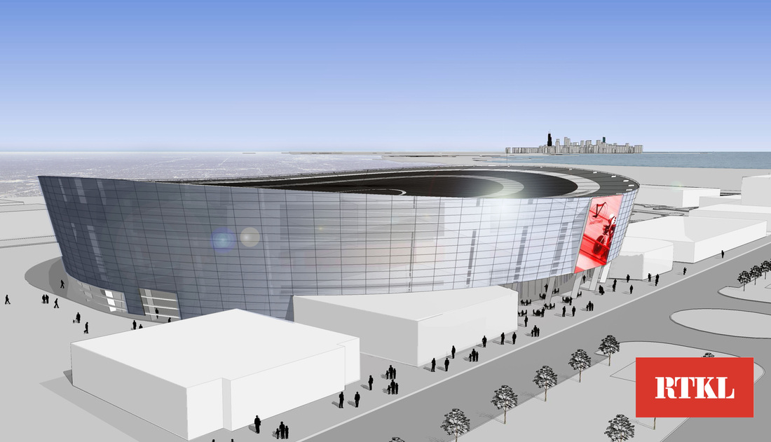 Location: Chicago, Il Architect: RTKL Associates Client: Chicago Velo Campus L3C Date Completed: 2013 Cost: $45 Million estimate Track Length: 250m Facilities Include: Art Indoor 250m Velodrome Track, Outdoor and Indoor Mountain Bike tracks (MTB), Outdoor Cyclocross Track, Triathlon Training Center, Wind Tunnel Facility, Indoor Olympic Sized Swimming Pool Indoor 400 meter Running Track, Fitness Center, Coaching and Education Facility Olympic Development Training Center, Youth Beginner, Elite and Masters Programs, Community Center, Physical Therapy and Sports Medicine Center, Sports Retail, Cycling Museum Restaurant, Cafe, and a Healthy Juice Bar Why is it good: This project is good in that is creates a community hub. It is the focus of this 500 acre site to include everything listed above as well as 13,000 homes on the south side of Chicago along the lakefront between 79th and 91st Streets. What you plan to learn from it: This design combines a mixed use facility with a cycling track. This solves 2 of my main problems when talking about sustainability. First it allows more people to occupy the space thus eliminating dead spots in time when the building is heating/cooling the space and no one is in there. And secondly it helps emphasize my intent as creating a hub not only for cycling but for people as well. This gets more people to the site which would not be there if it was just a cycling facility.
| 
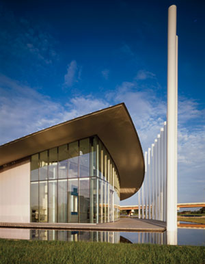
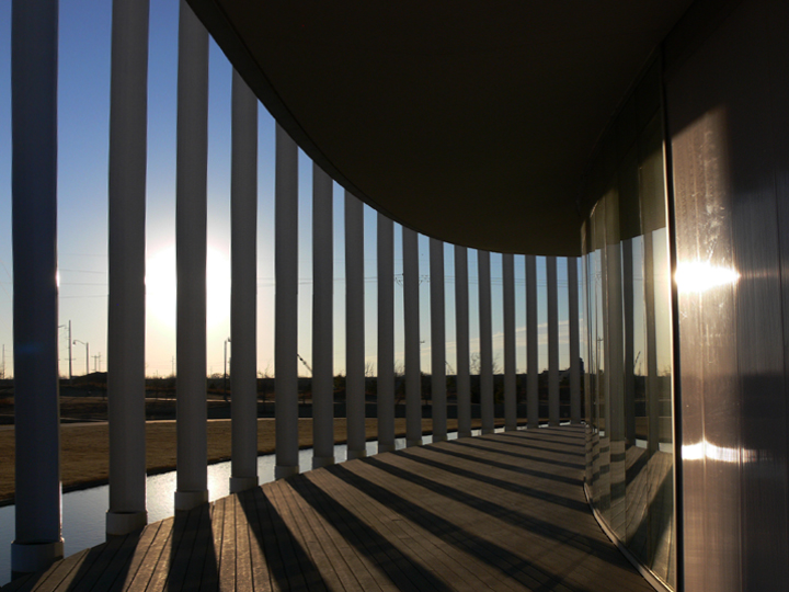
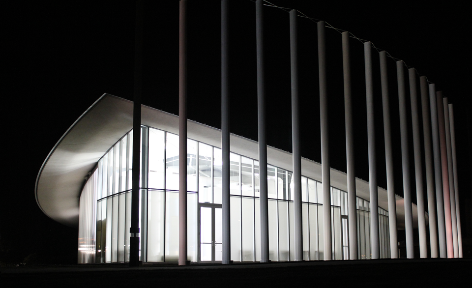
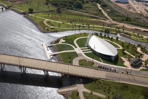
BloggerMy name is Andrew Stevens and I am a Graduate Student at the University of Oklahoma School of Architecture. This blog is for me to share with you my thought process and design images for a Net-Zero Velodrome in the Oklahoma City, OK area. Site Location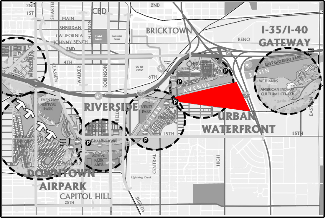
ArchivesMay 2013 
Thesis CommitteeChair: Marjorie P. Callahan
Member: Ronald H. Frantz Jr Member: I-Kwang Chang CategoriesAll  | ||

 RSS Feed