All models will be round
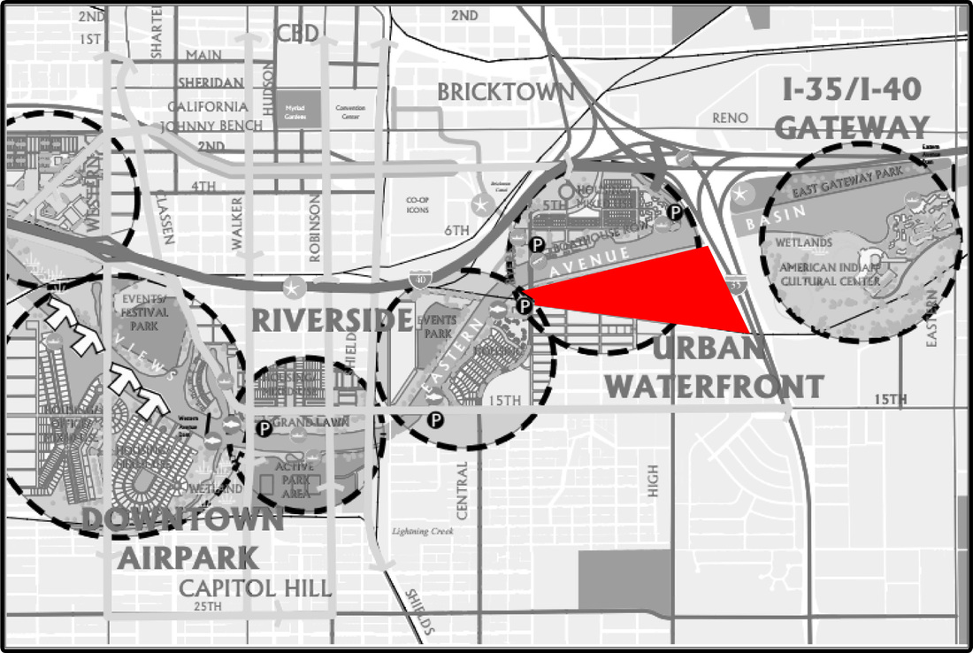
Now that the research is all done and the location has been selected it is time to start getting in depth with the site and surrounding area. This first model will be at 1"=400' scale so you can see my sites location in relation to the downtown OKC area. On this model I plan to show key features of the area using colored push pins I plan to show the following:
1. OKC River Trails network as well as other bicycling routes
into and around the city,
2. Driving routes from major highways to the main entrances of
the site and
3. The railroad tracks and how they detach my site from the
community to the south.
4. Locations of the Spokies kiosks (rent-able bicycles in the
downtown area) spokiesokc.com
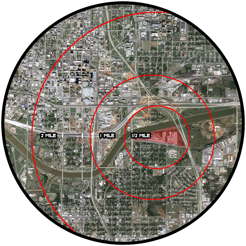
The model also shows travel distances from my site (red circles) to help show from what areas you could expect normal people to walk (1/4 to 1/2 mile) or bike (1 to 2 miles) to the facility. Avid cyclists as well as commuters are more likely to travel from greater distances to use the facilities.
1. OKC River Trails network as well as other bicycling routes
into and around the city,
2. Driving routes from major highways to the main entrances of
the site and
3. The railroad tracks and how they detach my site from the
community to the south.
4. Locations of the Spokies kiosks (rent-able bicycles in the
downtown area) spokiesokc.com
The model also shows travel distances from my site (red circles) to help show from what areas you could expect normal people to walk (1/4 to 1/2 mile) or bike (1 to 2 miles) to the facility. Avid cyclists as well as commuters are more likely to travel from greater distances to use the facilities.

 RSS Feed
